 |
THE BLACKNESS ADMIRALTY BATTLE PRACTICE TARGET BARGE
- an update, August 2007
 |
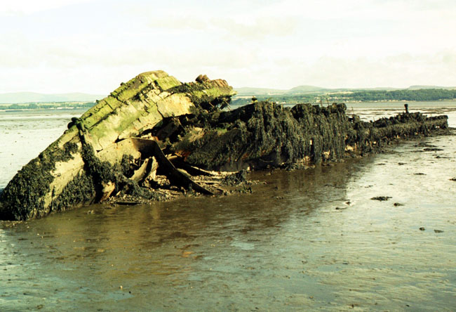 |
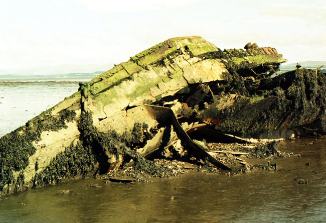
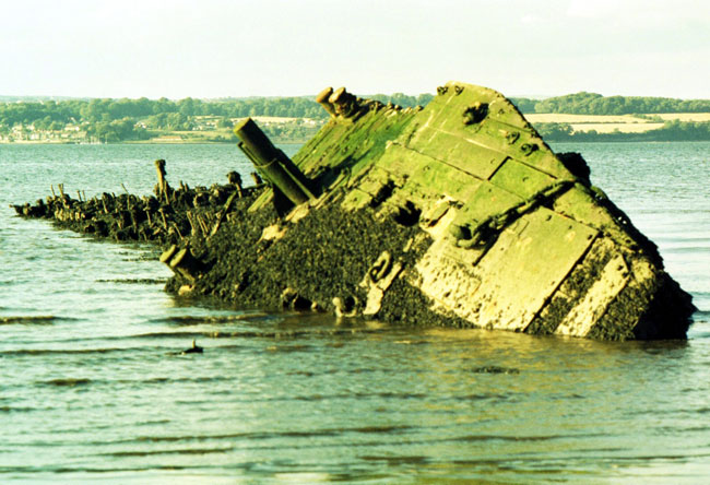
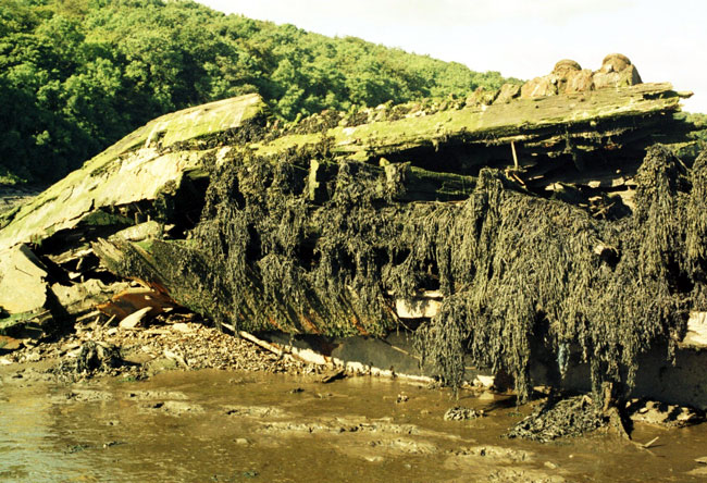
This August I went to have a look at the target barge, thinking it was due a visit as I could no longer see the scaffolding boards I had placed vertically on the east side to berth against. Sure enough, the boards had gone. The cause was a collapse of the bow section and remaining portion of main deck. This has fallen to the west and reduced the vertical height of the structure.
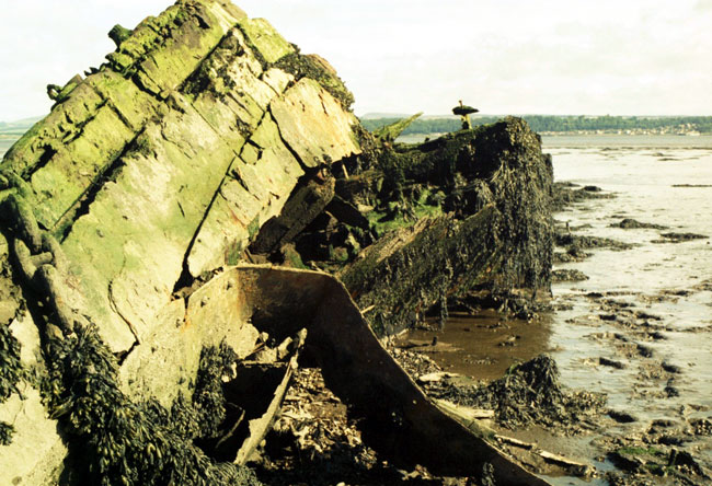
Following the collapse the barge covers on a spring tide. Berthing alongside is not possible until some form of skeleton jetty is erected. The chain hanging from the bow section now leads astern so the number of links visible does not serve as a depth gauge as it once did. There is a large piece of plating hanging from the bow, ahead of the former yacht berth on the east side, to be avoided. The towing strong point on the stem is now buried in the mud.
Why the interest? This is one of the more scenic and secluded spots on the Forth, the woods of the Hopetoun Estate coming right down to the top of the beach. There is a concentration of birdlife drawn by the freshwater of the Midhope burn a few hundred yards to the east and a view of the castle to the west. The barge itself is of sufficient nautical archaeological interest to merit an entry, with photographs, in the Royal Commission for Ancient and Historical Monuments Scotland (RCAHMS) Canmore database.
It is intended that a berth be arranged alongside the barge, perhaps on the west side this time. Until then it is possible to anchor and dry out to the east or west of the barge, avoiding the debris field. The ground is clearer to the east but care is required on the approach to avoid a large Admiralty pattern anchor to the north east and keep out of the anchoring exclusion zone.
Please note that in the photographs the footprints on the mud were made wearing mud boards. The mud is too soft to walk on without them.
|
|
 |
 |
info@fyca.org.uk
©dss2016