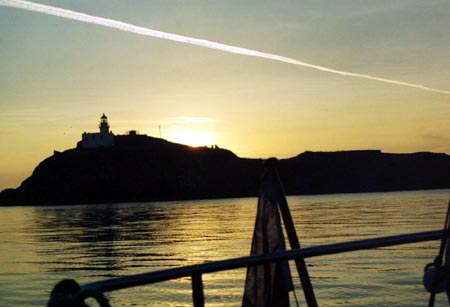
FIDRA ISLAND , ITS LIGHTHOUSE AND RAILWAY In good weather Fidra (1,2) is a lovely spot, far enough down river to find peace and solitude, the C12 th century chapel ruin suggesting Frank Carr’s words ‘where an older world of unspoiled beauty lingers on’. Indeed one can wax lyrical if the odd microlight aircraft and occasional weekend wall of sound from an illegal rave on the mainland are ignored.
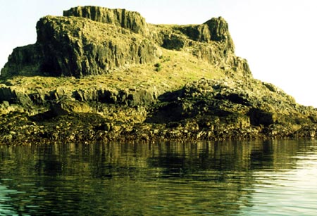
The island is a basalt intrusion and comprises two hills, a north one with the lighthouse and a flat topped southerly one joined by a low lying isthmus with beaches of smooth round stones. The island rock has something of a columnar look but not the classic polygonal columns seen on the north side of the Firth at Kincraig Point.
The attractive anchorages to the south, east and west, much used by old time pilot boats, provide a modicum of shelter. The southerly one becomes noticeably more sheltered near low water. Swell can make the anchorages uncomfortable but with careful weather watching and planning one can have an entertaining exploration and a delightful night at anchor.
For anchorage in an easterly blow one will probably head up river to the west side of Inchkeith but tidal harbours are not far away, N. Berwick 2 ½ miles, Elie 7 miles and St Monans 8 miles so there are plenty of diversionary options.
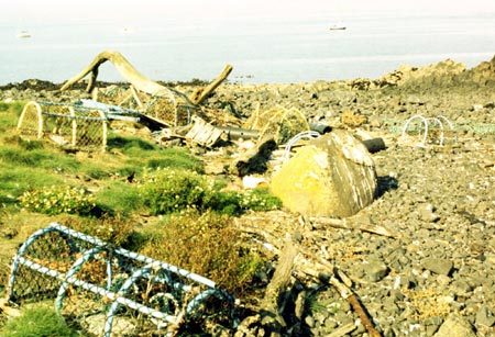
Beach combing The tidal streams and exposure of the mouth of the Forth make the island’s isthmus a rewarding place for beachcombing. Plastic waste accumulates here and is largely old lobster creels, nephrops traps, buoys and fenders. Timber of all descriptions, ladders and scaffolding boards too find their way on to the rocks. This debris is interesting to look at to see what birds will nest in, on and under and the risks they take nesting within reach of the waves.
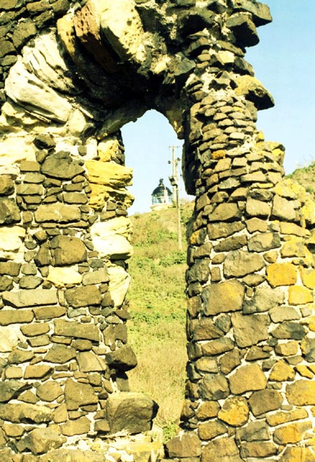
Chapel ruin This chapel was dedicated to St Nicholas in 1165. Part of the south wall with one very weathered lancet window of rustic charm is the main surviving architectural feature but unfortunately is nearing collapse. The building appears to have had very little dressed stone in its construction, conjuring up images off monks erecting the building from stones gathered on the island. The point of the lancet is soft imported stone, dressed to form the arch. Unfortunately being soft it is badly eroded.
The chapel may have been a lazaretto, a hospital for people with infectious diseases, according with its location in the mouth of the Forth. Here sick crew and passengers who would otherwise have been an impediment to free practique could have been landed before entering port further up the river.
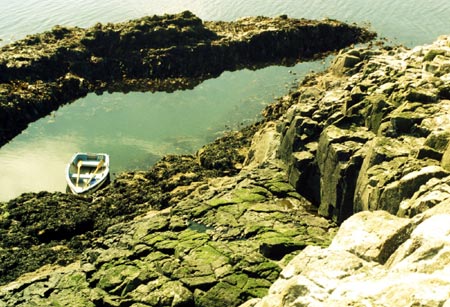
Dinghy exploration Rowing round the island is the best way to explore its coves and give the birds some space.
There is a concrete landing on the west side and a more extensive concrete pier on the east. Neither are much help to yachtsmen but the stony beaches at the isthmus provide dinghy landings on the east and west sides.
The easy way up Castle Tarbet is a zigzag scramble up the south side, most easily reached by dinghy, leaving it in a conveniently sheltered gulley, where one can step ashore with dry feet and keep an eye on it from above. This gulley covers on high tides.
It is worth bringing a hard dinghy for an exploration. It is much easier to row than an inflatable, adding to the enjoyment and the landings are punishing to inflatables. Towing a dinghy to the island gives an insight into the difficulties yachtsmen had to contend with before inflatable tenders came into common use.
I visited during an equinoctial low water and while revealing conditions for a pilotage recce, low tides can mean a long row round the Briggs of Fidra reef.
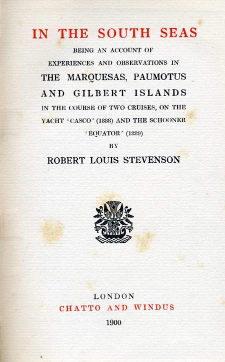
Fidra in literature The shape of Fidra is said to have inspired Robert Louis Stevenson’s map of Treasure Island. Like Treasure Island, the north end of Fidra has a large natural rock arch that can be seen through. RLS also mentions Fidra in his novel Catriona and we know he was a frequent visitor to Yellowcraigs, the nearby mainland beach. The spine of my copy of “In the South Seas” stares at me as I write. Clearly RLS loved the sea and islands and his time in East Lothian can be viewed as a formative beginning.
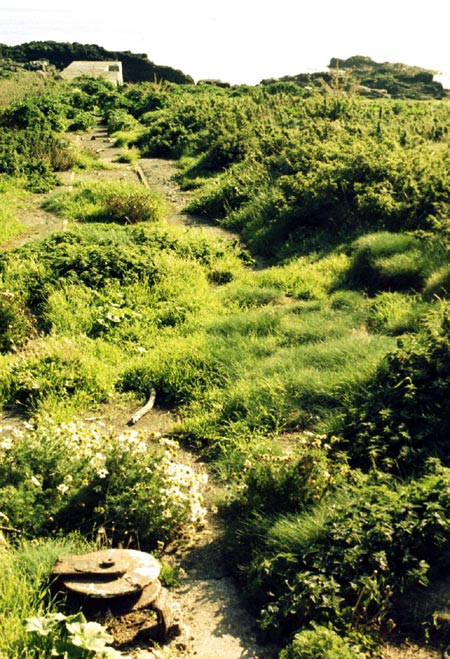
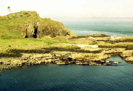
The lighthouse and railway The lighthouse (3), built in 1885 by Thomas and David Stevenson, looks common enough. An interesting feature is the cable drawn narrow gauge railway from the concrete quay on the east side up to the lighthouse. Most of the rails and the sheaves used to guide the winch wire are still in situ, embedded in the concrete path but it is becoming very overgrown. One sheave was seen in the water by the quay. It is surprising that railway buffs do not appear to have documented this short section of track.
Natural history The island has thin soil covered by turf, important puffin nesting ground and it is an RSPB reserve. Unfortunately dense stands of the garden escape tree mallow (4)Lavatera arborea on this and other Forth islands are denying puffins the turf for the burrows they make when nesting. Nitrogen and phosphorous contributed by the birds makes this weed growth explosive. Eradication trials by the Scottish Seabird Centre (5) and the Centre for Hydrology and Ecology are in progress on the neighbouring island of Craigleith.
When walking on Fidra one is asked to avoid the turf as much as possible, especially higher up, so as not to collapse puffin burrows. Late summer or autumn is the best time to visit, many of the birds have gone out to sea by then, rain has freshened the island and greened the vegetation. The present struggle for breeding success can lead to flightless juveniles present later than expected and one should try to avoid disturbing them as they are unlikely to get a friendly reception if chased into neighbouring birds’ territory.
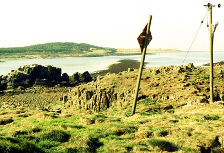
Under water cables Armoured submarine cables can be seen on the shore at the south end of the island below the marker, both redundant and in service. They are power and telephone cables for the lighthouse.
Links
1. Fidra Wikipedia: http://en.wikipedia.org/wiki/Fidra
2. Fidra aerial photographs: http://www.rcahms.gov.uk/pls/portal/canmore.newcandig_details_imgsummary?inumlink=210191
3. Fidra lighthouse: http://www.rcahms.gov.uk/pls/portal/canmore.newcandig_details_gis?inumlink=79779
4. Craigleith tree mallow project: http://www.billbruce.me.uk/treemallow/page01.htm
5. Scottish Seabird Centre Fidra webcam: http://www.seabird.org/webcam-fidra.asp
Paul Shave yacht Blue Spindrift November 2008 |
|
info@fyca.org.uk
©dss2011