 |
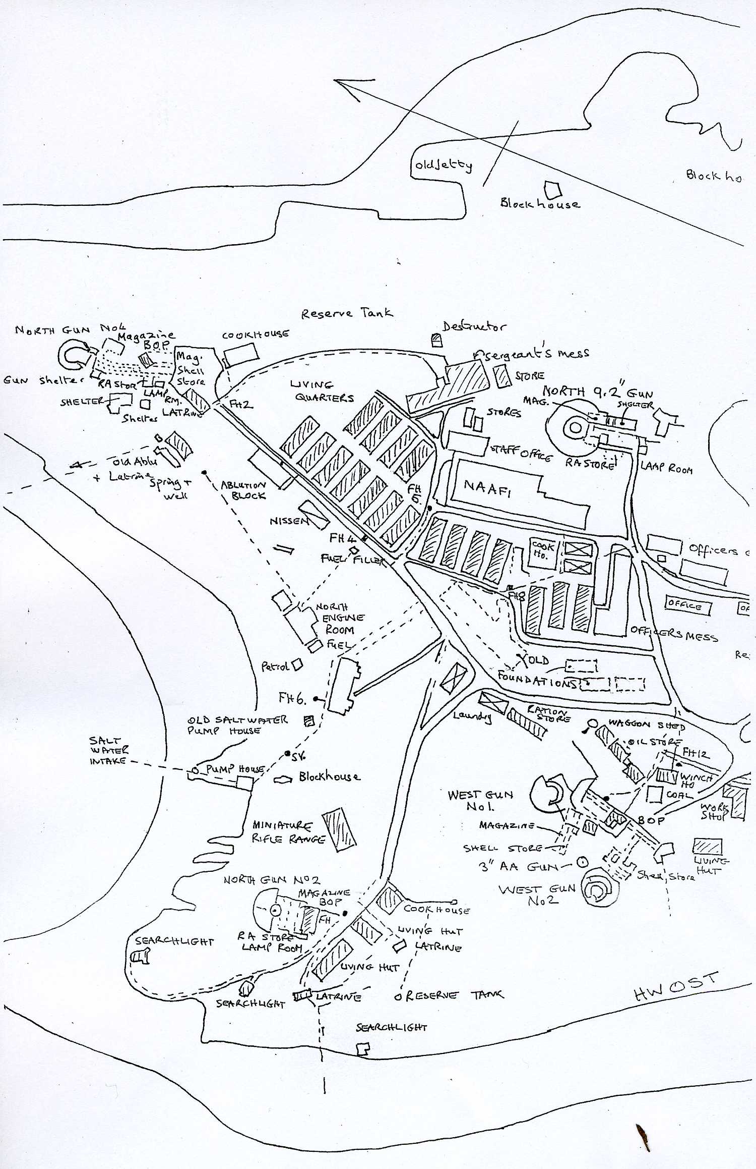
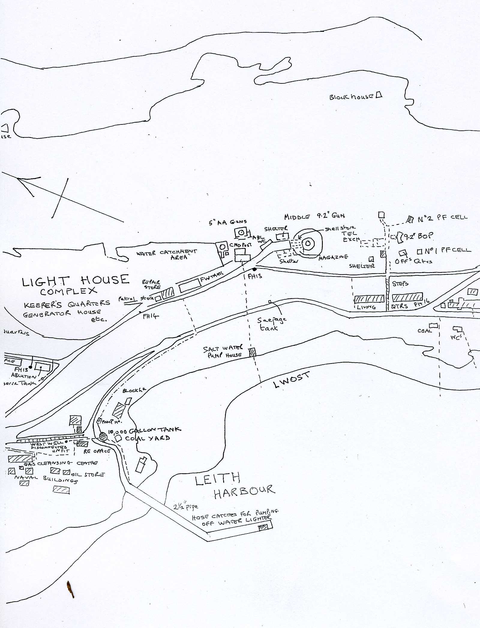
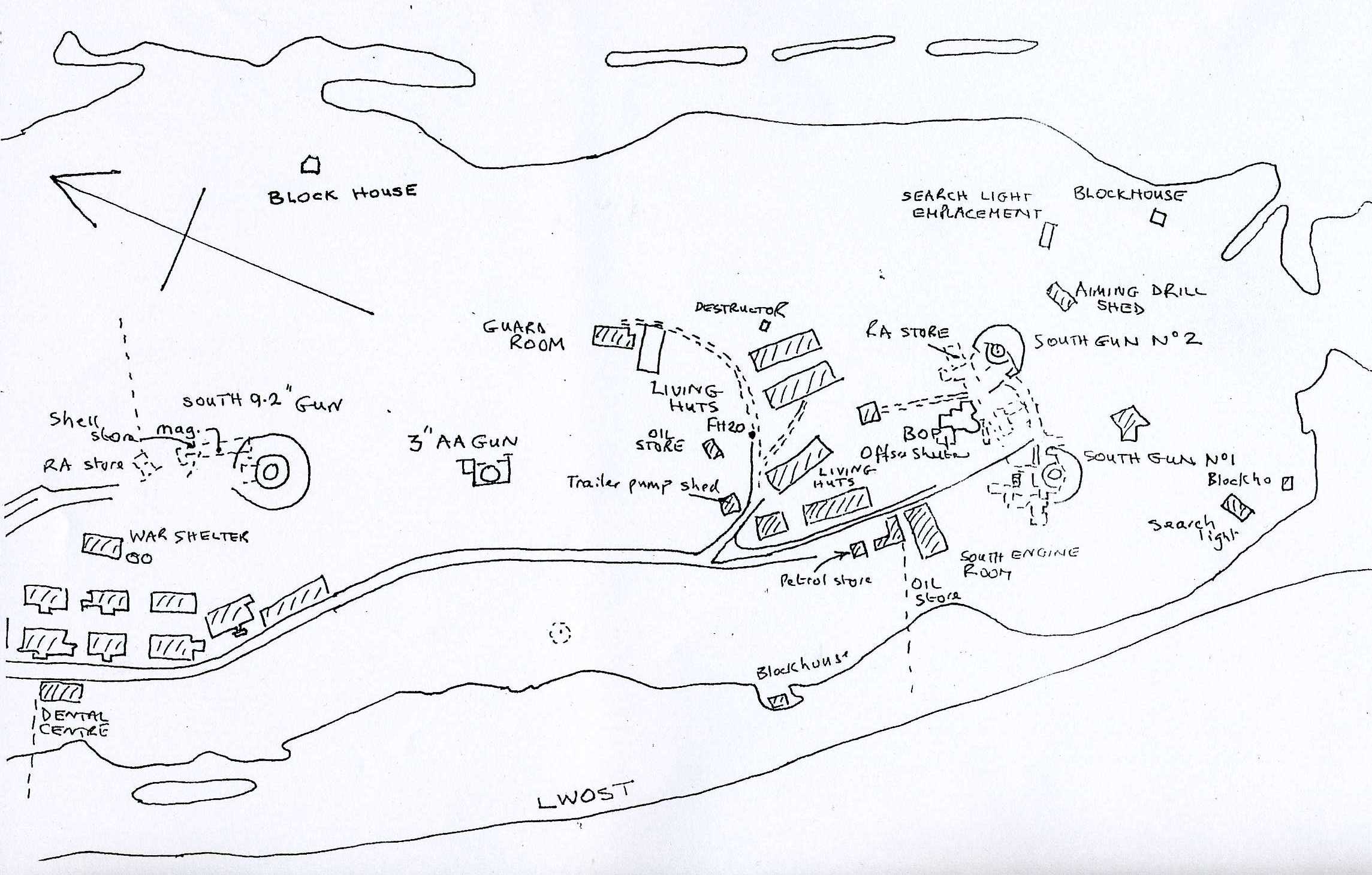
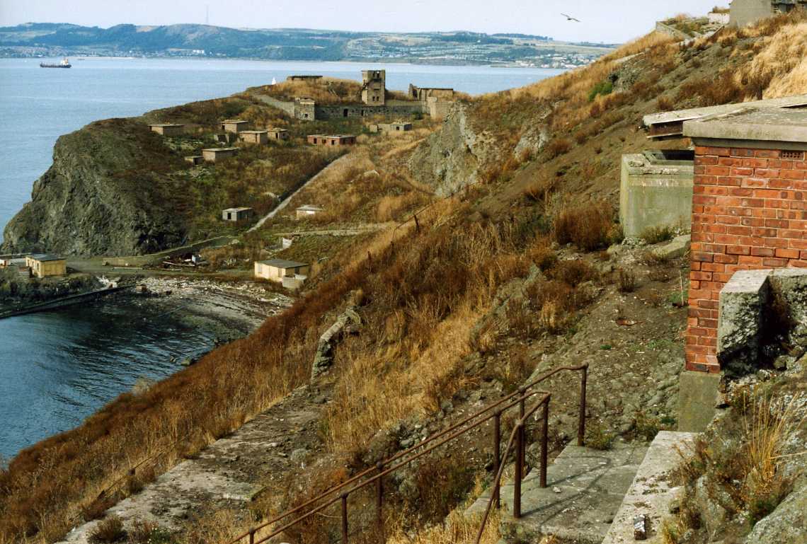
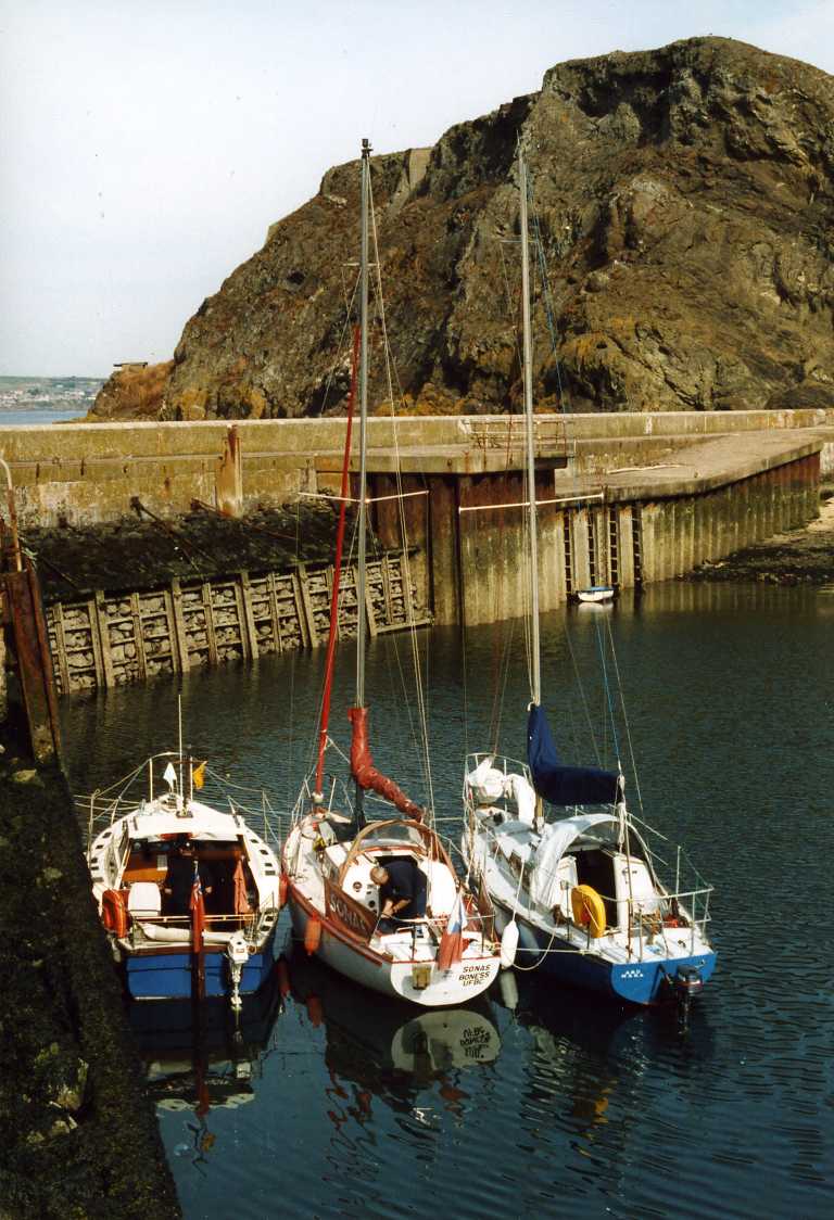
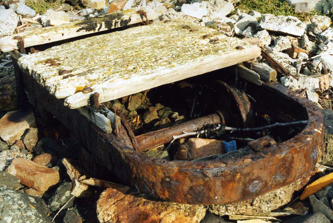
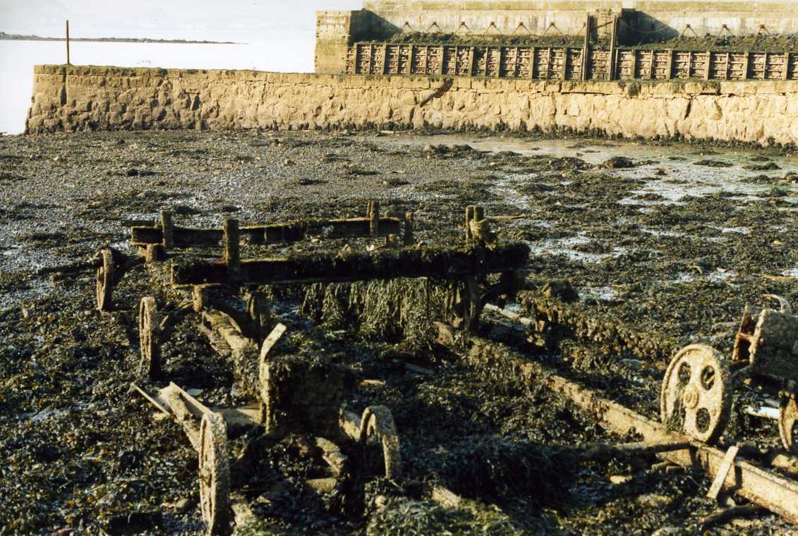
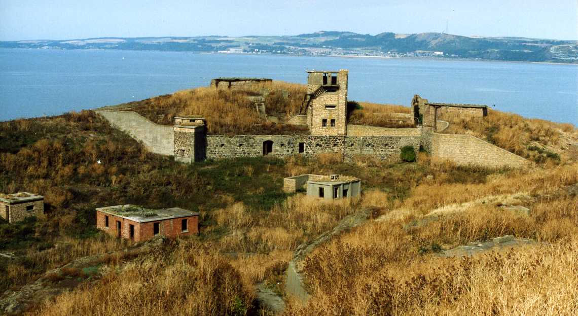
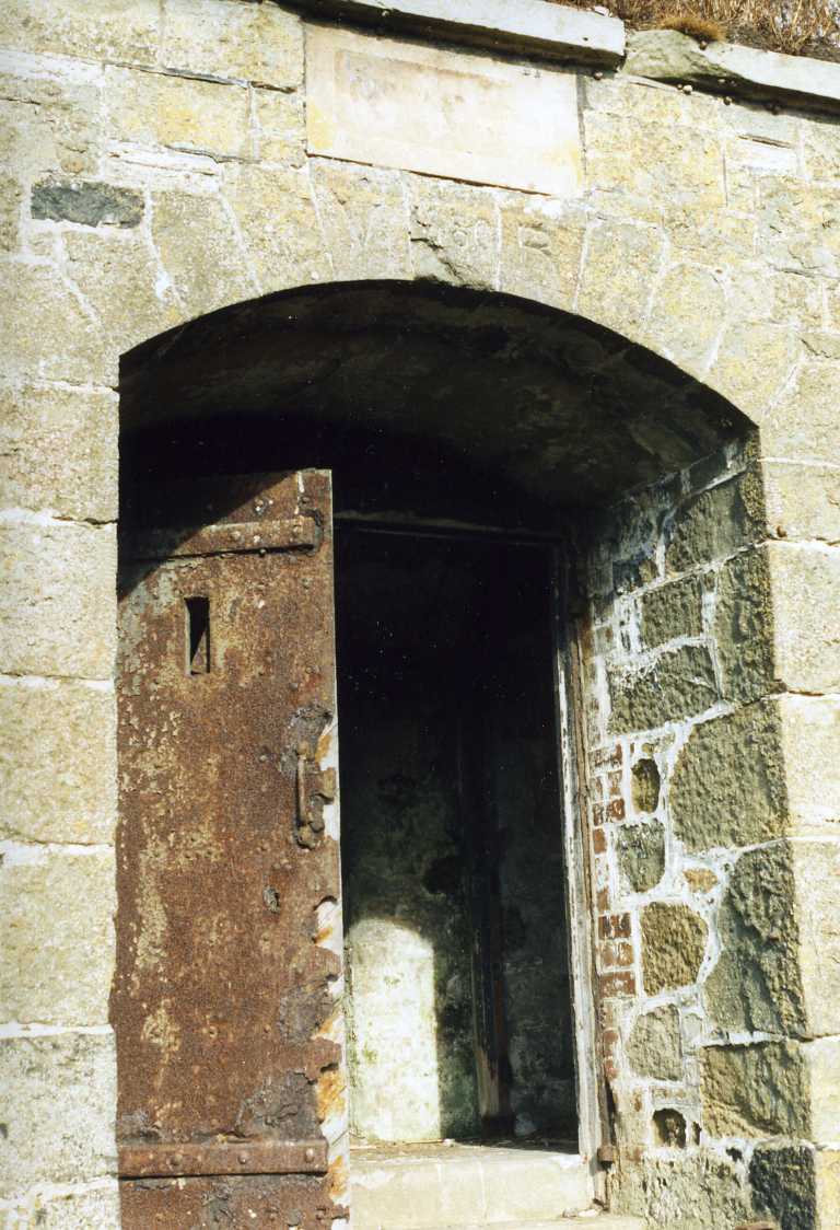
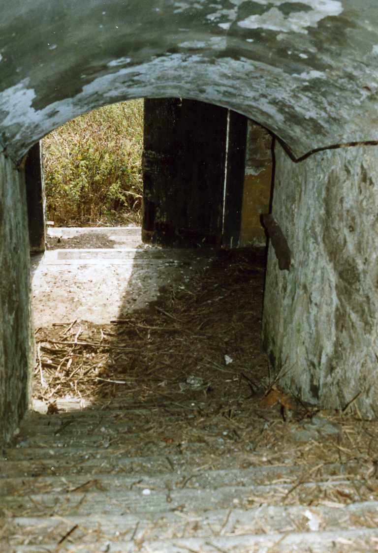
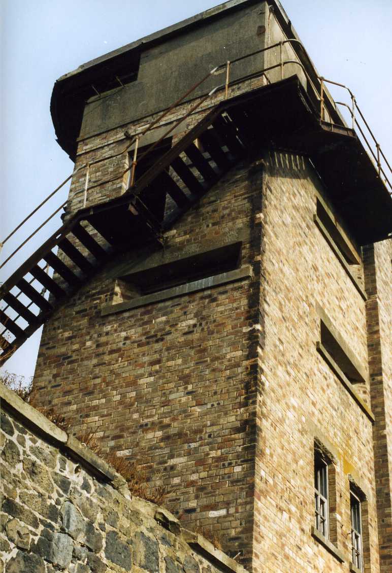
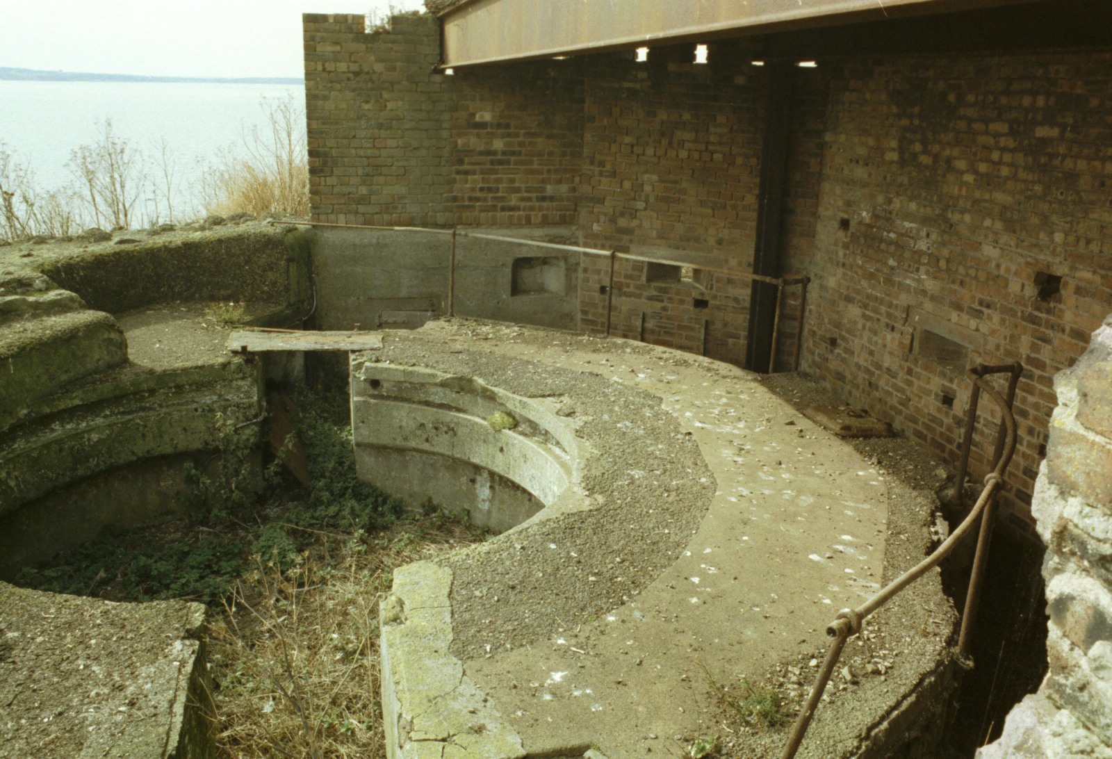
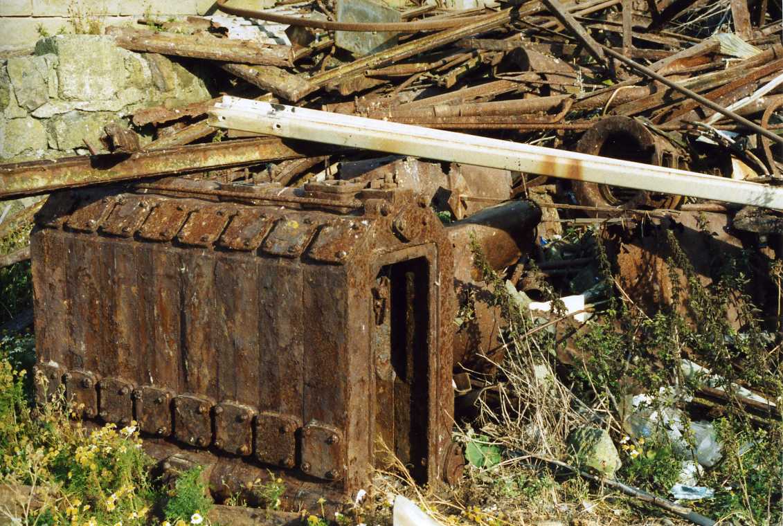
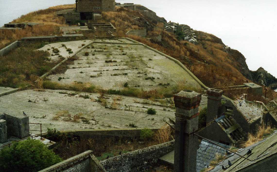
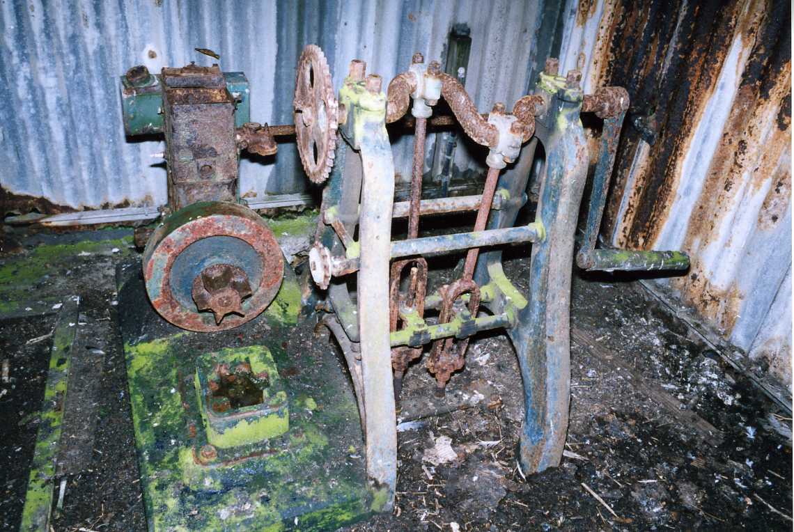
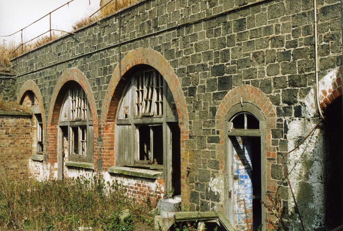
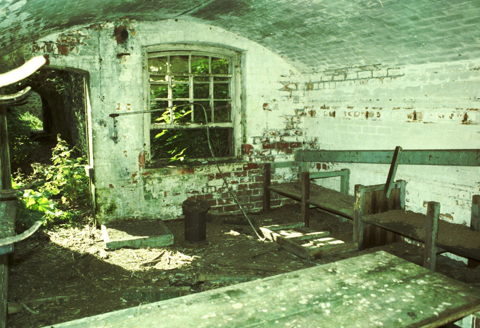
INCHKEITH ISLAND With a harbour of its own and being surrounded by yacht clubs the island gets a fair number of visitors, some drawn by the prominent fortifications. The purpose of this article is to inform that the island is privately owned, has legal protection as a scheduled archaeological site, raise awareness of some of its dangers and help with interpretation. This section owes much to research in the UK Public Records Office and National Archives and a report on a visit to the island by the late Peter Cobb, Chairman of the UK Fortifications Club, now amalgamated with the Pillbox Study Group. The following brief digression is a tribute of nautical interest. Hugely knowledgeable, Peter had been a Government advisor sent to Dubrovnik after its bombardment 1991-2 to advise on the damage to its ancient fortifications. Very unassuming, he introduced himself to me as a postman, his retirement occupation. In fact he had been a ‘slinger’ in Portsmouth Royal Naval Dockyard. Greatly respected, his role in stabilising HMS Victory during the Great Gale of 1987 was legendary. Receiving a call from the dockyard to stabilise the ship, her keel moving sideways, he set off by bicycle his mode of transport, from home on Portsdown Hill but the wind was so strong it blew him back up the hill. A call to the base brought a staff car and he and others were able to get to work adjusting the shores in the dry dock. Detail of Peter’s Inchkeith research and photographs of a club visit in September 2004 appeared in his report “Fort of the Quarter, Inckeith Island” (1) was on the former UKFC website. In its absence the Wikipedia entry and other links below (2,3) are useful. Fortifications galore Inchkeith Island was the central strongpoint of ‘Fortress Forth’, the defence in depth of Rosyth Royal Naval Dockyard and the fleet anchorage. Development of the island reached its zenith during the Second World War but its origins go back a lot earlier. The most visible fortifications on the island date from the 1880s (4) onwards but traces of a fort from 1547 remain. There are more fortifications in a confined area here than almost anywhere else in Europe. Despite neglect and the depredations of scrap metal collectors they are in a remarkably good state of preservation, rather better than the mainland coastal batteries fringing the Forth and many of the Atlantic Wall fortifications of continental Europe, having been protected by island isolation. They thoroughly justify their scheduled site status and the legal protection this affords under the Ancient Monuments and Archaeological Areas Act 1979. The site was rescheduled in 2002, extending the scheduled area to include the whole island and an area offshore to include any associated archaeology. The Royal Commission on Ancient and Historical Monuments of Scotland (RCAHMs) interest is developing as indicated by their visit of July 2009 (5). It is hoped that one day the island will be accessible to the general public as are many of the strong points of the battle for Normandy. Risk management To one who grew up on army camps and has explored old fortifications home and abroad this island is a dangerous place. It brings to mind the words of Edward Whymper: “ Climb if you will, but remember that courage and strength are nought without prudence, and that a momentary negligence may destroy the happiness of a lifetime. Do nothing in haste; look well to each step; and from the beginning think what may be the end.” The detailed UKFC report, including armament data, runs to 31 pages and strikes a cautionary note. Whilst the Land Reform ( Scotland) Act 2003 provides the right to walk on core paths “the right to roam” it will not stop you falling into one of the many traps on the island. Even on the paths one is not spared these, such as the gaping hole down to lower levels of the central command post on the ridge. Holes abound where cast iron manhole covers have been removed for their scrap value, often adjacent to paths. So if you visit, the advice is keep out of the buildings, stick to the paths and watch every step. Apart from personal safety and the spirit of the Act there is so much to see in the open it makes better use of limited time ashore. The ground is rough and heavily contaminated with bird debris so it is advisable to have up to date tetanus inoculations. Other health hazards include histoplasmosis from disturbance of guano dust and degrading asbestos sheeting. Objective dangers include: Guano covered rotten suspended wooden floors and steps Unstable buildings Rusted ladders Vegetation covered ditches and water storage cisterns Hidden rabbit burrows Loose earth above drops Shelf brackets at eye level in dark passageways Slippery surfaces from bird droppings, lichen growth and wet weather Startled pigeons exiting buildings at high speed Visiting Inchkeith September is a good time to visit. The young seabirds will have departed and there is often settled weather at this time of year. Any earlier and flightless birds will be encountered with risk of disturbing them. Later in the year when there has been some rain the vegetation is greener up and the island has less of an overpowering smell of birds. The island is very overgrown now that it is uninhabited. Old clothes are necessary as they get covered in burrs, as will a dog’s coat, pushing through the vegetation overgrowing the paths. The island has amongst the lowest rainfall in Scotland and the shoulder high weeds get bone dry. Freshwater supply was a constant problem for the troops on the island in WWII, evident on arrival at Leith Harbour where looking up at the cliffs, pipes have been laid to collect water from seeps in the rock strata. One sees seawater pumping installations on the shore, water tanks all over the island and on the ridge a large paved rainwater collection area with associated cisterns. The dual seawater and freshwater pipe work, fire hydrant piping, underground electric cables and telephone lines are why there were so many manholes on the island, mostly now uncovered. In the east anchorage the author has hooked a redundant armoured cable so be prepared to support one of these with the bight of a line whilst freeing the anchor then releasing one end of the line to drop the cable. There are usually numerous creel markers round the island, worth noting them in case one has to move ones boat after dark. Less obvious artefacts on the shore At the harbour the crane and the stationary engine in the pump house at the nearby well have gone but interesting relics abound. At the top of the beach near the pier are two half buried military narrow gauge railway shot or shell trucks. Very few of this round end variety are known to have survived. They date from the 1880s or early 1890s and even in their present condition should be in a museum. The UKFC missed these during its visit. Peter Cobb highlighted their rarity when commenting on the author’s photographs. Also on the shore in the harbour are the remains of a WWII boat beaching system. This comprises a multi-wheeled carriage running on four rails. A belly band for the boat lies nearby. Given its function it is usually covered by the tide when visitors arrive near high water so is often missed. On the south east shore one can find the partially buried casings of two large naval moored contact mines, their lids removed and Hertz horns missing, suggesting that this area was used for explosive ordnance disposal. No other munitions have been seen. Identifying the main features Walking up the hill from the harbour one soon sees tracks of the cable drawn narrow gauge military railway used to transport heavy ammunition to the magazines under the gun emplacements. Most of the ammunition was never used so it made the return journey by the same means. On first acquaintance the complexity of the site can be a bit overwhelming and details of the armament mounted, gleaned from war diaries, are confusing. Identifying the main features, the Victorian forts, the south and north east were completed in 1880 and the west a year later. Ten inch muzzle loading guns were mounted in them, two in the south fort and one each in the other two. These were removed in the early years of the twentieth century. The next major armament was 9.2” breech loaders in each of the three big gun emplacements seen on the skyline from the east. Meanwhile a host of smaller calibres had been deployed, five 6’’ breech loaders and some 4.7” quick firers. These were supported by machine guns and riflemen in fire trenches. In the run up to the First World War defence activity was stoked up by the publication of Erskine Childers’ Riddle of the Sands. As the Second World War approached, a pair of 12 pounder quick firers and two 3” anti aircraft guns arrived and in 1941 another two 3” anti aircraft guns. In 1940 the big gun emplacements were roofed over with rolled steel joist reinforced concrete against air burst shells and air attack. Later that year the island guns shot down a raider over the Forth. In 1943 the four 3” anti aircraft guns were replaced by four 40mm Bofors. Over time the machine guns were upgraded, Brens replacing Lewis guns and Sten and Thompson sub machine guns issued. Search lights, their generators and fuel storage, communications, observation posts, fire control systems and water pumping add more layers of complexity. Damage control included ample provision for fire fighting using piped sea water. A small bore range and training battery provided for weapon training. To this one can add accommodation for 900 men and all the supporting services they required for extended stays, including a dental surgery. Entertainment for the men seems to have been limited to an extensive NAAFI building. The yachtsman will, like the island’s mostly conscript former inhabitants have time to explore the island whilst sheltering from strong winds, waiting out adverse tides or for fog to clear. The island has varied geology and interesting fossil remains (6) and one Royal Engineer Colonel used his time to investigate and write it up. Exploring the coastline by dinghy, on looking at the North East landing one begins to get more of an impression of how long people have worked on this island fortifying it, operating a very substantial lighthouse, importing vast quantities of building and war materials, provisions, fuel and drinking water. The lighthouse
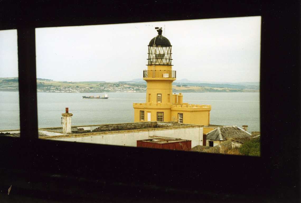
The Forth had the first lighthouse in Scotland on the Isle of May and Inchkeith is notable as a test bed for lighthouse technology. Here Robert Stevenson tested the Argand lamp and Fresnel lenses. The lens trials were continued and successfully concluded by his brother Alan (7) and by 1847 Fresnel lenses were widely adopted. The crenellations round the roof of the building and sparkling panes of the lamp house give it regal appearance. Whilst now an automated electric light, earlier equipment can be seen and the keepers’ house still stands. The weather vane on the top of the light is most useful, being visible from the east anchorage and when waiting for fog to clear, the beam of the light sweeping the sky provides an early indication of the visibility improving. There is no fog horn, making for a good night’s sleep. Unfortunately the weather vane can’t be seen from the harbour. An impressive plaque above the lighthouse entrance tells something of its history, more of which can be found on the Northern Lighthouse Board website. (8). The light has changed many times with the evolution of technology and is now automatic, with a characteristic of Fl 15s 67m 22m. Bibliography 1. “Fort of the Quarter, Inchkeith Island”, Peter Cobb, UKFC, September 2004. 2. http://en.wikipedia.org/wiki/Inchkeith 3. http://www.geo.ed.ac.uk/scotgaz/features/featurefirst33.html 4. New York Times article 1881 http://query.nytimes.com/mem/archive-free/pdf?_r=1&res=990CE0DD133EE433A2575AC1A9619C94609FD7CF 5. http://www.rcahms.gov.uk/rcahms-visit-inchkeith.html 6. http://www.jncc.gov.uk/pdf/gcrdb/GCRsiteaccount172.pdf 7. “The Lighthouse Stevensons”, Bella Bathurst, Harper Collins, 1999, ISBN 0 00 653076 1. 8. http://www.nlb.org.uk/ourlights/history/inchkeith.htm
Paul Shave yacht Blue Spindrift 2 September 2009 |
click on any image to see enlarged version
|
info@fyca.org.uk
©dss2016