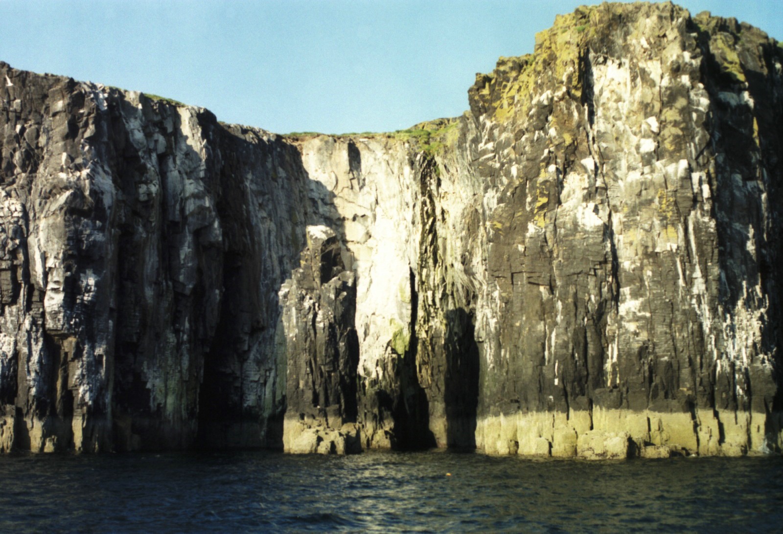
Often called the ‘Jewel of the Forth’ this beautiful island is more remote than its proximity to the mainland might suggest as local access is from tidal harbours. Good weather is essential for a comfortable visit because of its exposed location and open anchorages. Cliff scenery, bird life, seals and the chapel ruin make it a most attractive destination. Trip boats operate from Anstruther but the island copes well with the number of visitors.
Landings and anchorages
Landing is permitted on the north west of the island at the Altarstanes and in the south east at Kirkhaven, a creek with a concrete quay. The Altarstanes landing is wide open to the west. Whilst often sheltered during the day, when the sun goes down and the sea breeze dies, the prevailing south westerly can re-establish itself creating a dangerous lee shore, the more so as the water depth necessitates anchoring close in. The FYCA Pilot Handbook entry is now out of date. The Altarstanes can no longer be located from the Bailey bridge spanning the chasm to the isle of Rona as it has been removed.
On the east side, East Tarbert offers a little more shelter but landing is forbidden as nesting grounds would have to be crossed to reach the path, with risk of disturbing thin vegetation and ground nesting birds.
Kirkhaven is busy with trip boats so is not much of an option for yachts but it is possible to anchor outside the inner end of the creek and land there by dinghy with a scramble over rocks. Overnight mooring at Kirkhaven is not permitted.
With care, anchorage hopping is possible but moving a boat after dark is complicated by the numerous creel markers and the rocks extending off the north and south ends of the island. When entering or leaving the Forth these anchorages can be useful, not being constrained by tidal access and they are most scenic places to lie. Fishing boats use them to wait for the tide, trawlers lowering an otter board as a temporary anchor.
In days gone by emigrant vessels anchored off the bay of Pilgrims’ Haven to load the smooth stones as ballast.
Guidance for visitors
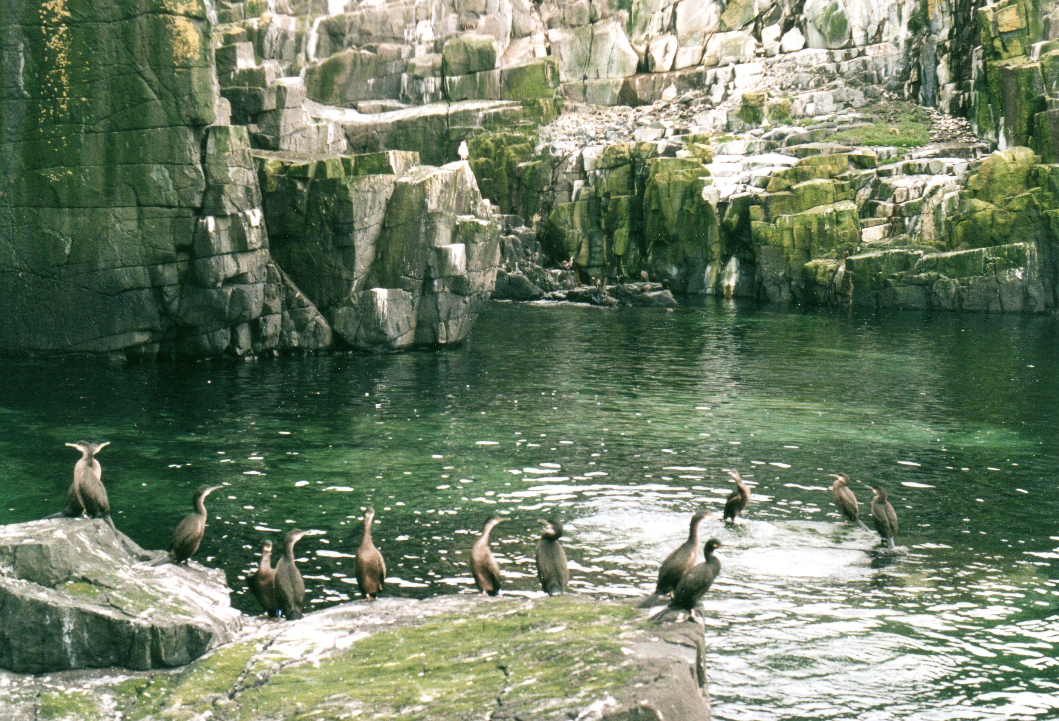
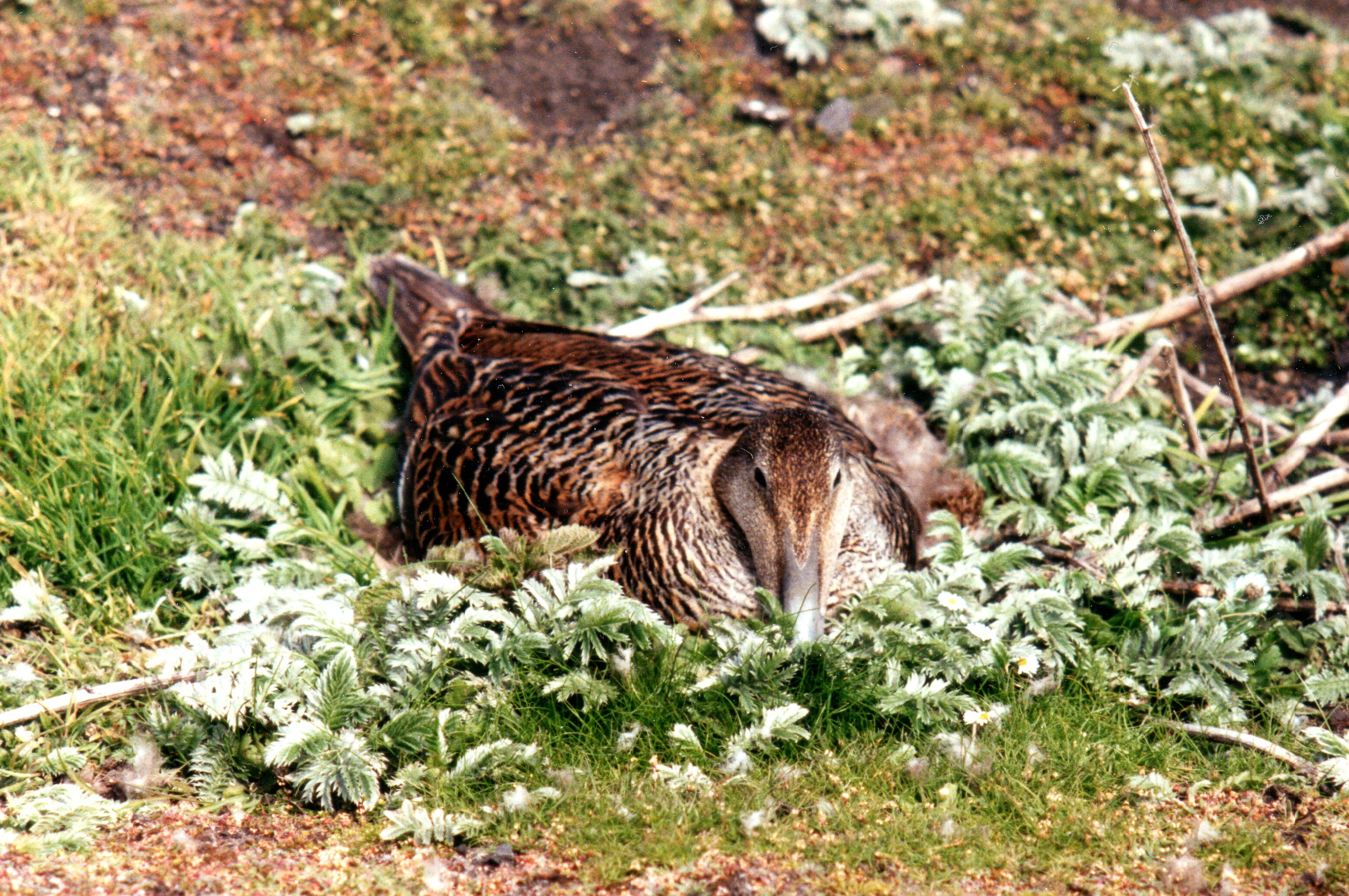
Sea birds are under such pressure from loss of nesting sites and competition for their food sources that they have priority on this island, a National Nature Reserve. Its nesting grounds are important being located on the east-west and north-south migration routes and it has numerous seal pupping sites. Eider nest so close to the paths that the birds are almost under your feet. Whilst lovely to see at such close quarters the sitting birds are not tame, just reluctant to leave their nests. If the sitting bird is scared away, gulls will rob the nest eating eggs and small chicks in less time than it takes to tell. Whilst the May does not have the extensive haul out areas of the Tentsmuir sands to the north and Holy Island to the south, it is roughly in the middle of the largest grey seal population on the east coast of the UK so the available pupping sites are crowded.
When planning a visit the SNH publications catalogue has beautifully illustrated guides available as free downloads. Most of them can be picked up in Anstruther and other Fife centres. On the May there is a small visitor centre with toilets. Guidance for visitors mostly boils down to consideration for wildlife; afloat giving it a wide berth at slow speed and on-shore keeping to the paths. Dogs are not permitted on the island because of the numbers of ground nesting birds. For a short guide Hamish Haswell-Smith’s chapter on the Isle of May (1) is also highly recommended. The author’s architect’s eye for detail is reflected in his sketches, particularly the beauty of the lancet windows of the chapel ruin. He includes brief coverage of the archaeological investigations of the 1990s. An early Christian church and prehistoric remains were found.
The visitor can help look after the island and show his appreciation of the efforts made by the SNH wardens by picking up any litter on the paths and taking it away.
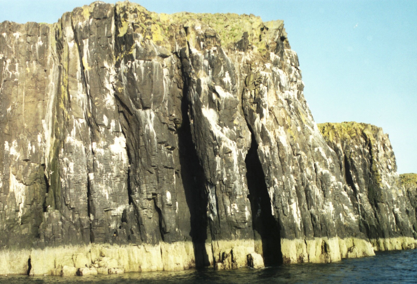
From seaward the cliffs can be approached close to but during the nesting season are best given a wide berth as guillemots are easily disturbed when nesting and the resulting commotion can lead to eggs and chicks getting pushed off ledges. Keeping clear also spares one from the droppings that rain down closer to the cliffs.
Further reading
One of the pleasures of cruising in Scottish waters is the wealth of literature. John Dickson’s Emeralds Chased in Gold (2) gives a mainly historical treatment of the Forth Islands, much used by later authors. On the May until the dam was built to create the loch, drinking water was limited and Dickson gives useful description of the five wells on the island which are inclined to salt water ingress and to dry up in summer. Emeralds has several references to caves having been used by smugglers but little specific beyond mention of one near the South Ness. It records that a few years prior to its publication in 1899 a smuggler’s hiding place was discovered whilst excavating at the head of Kirkhaven to extend the pier.
The Isle of May, A Scottish Nature Reserve (3) by W.J. Eggling is a general account with detailed treatment of the botany and zoology, the author having been a scientist employed by the Nature Conservancy Council, the forerunner of SNH. The map on the end papers of this book is by far the most informative that I have come across, naming the wells, Shag cave and Press Cove. The latter has a cave with difficult access reputed to have been a refuge from press gangs. One can imagine small fishing boats dodging round the stacks to keep out of sight of press gangs and excisemen.
Keith Brockie’s One Man’s Island (4) has introductory text to each chapter followed by his wonderful paintings and sketches of animal and plant life.
Ron Lockley’s Grey Seal, Common Seal (5) will satisfy much of the curiosity of those who want to know a bit more about the lives of these animals.
The Story of the May Island (6), a booklet published by the Largo Field Studies Society, gives a short very readable round up of history and wild life.
Keeping safe on the island
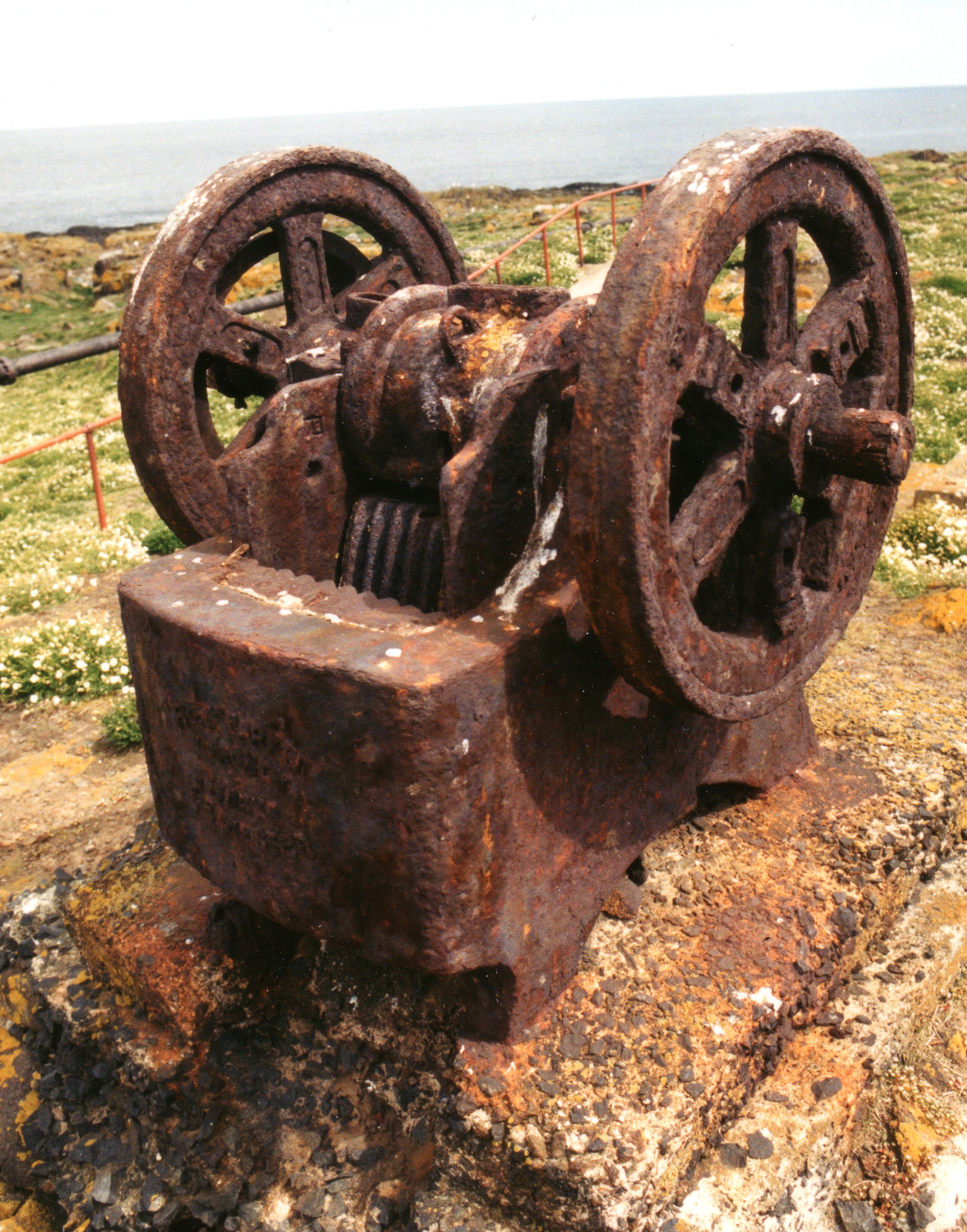
Some of the hazards of this island are not so apparent as the exposed anchorages, off-lying rocks and sheer cliffs. The small island of Rona off the North end of the Isle of May has been isolated by the removal of the Bailey bridge that formerly spanned the cleft between the two. Besides providing access, this bridge supported a cast iron pipe that took compressed air to the north fog horn. The bridge’s concrete abutments can still be seen. This isolation is good for the birds but makes the islet significantly more difficult of access and dangerous for rescue agencies. Kirkhaven is a refuge of limited utility being a trap should the weather come onshore.
The wrecks of the s.s. Anlaby off the Altarstanes and the s.s. Mars on the North Ness, now popular sub aqua dives, indicate the dangers of a rocky island in the middle of the mouth of the Forth dividing the shipping lane, especially given the prevalence of haar in the spring and early summer.
Bob Baird’s Shipwrecks of the Forth (7) lists 51 wrecks round the May. His book gives a résumé of ‘the battle of the May Island’ in 1918, when collisions during fleet manoeuvres led to the loss of two steam powered submarines. For a more detailed treatment see The K Boats (8 )by Don Everitt. Recent wind farm surveys (9) have produced remarkable side scan sonar images of the two submarines on the sea bed.
More wrecks are continually being added to the lists as a result of the increased deep diving capability afforded to amateurs by the wider availability of the oxygen enriched gas mixture Nitrox. One needs to keep eyes open for the ‘A’ flag on dive boats and diver’s surface marker buoys meaning ‘divers down keep clear at low speed’. The most likely shipping casualties today are fishing boats foul on their own gear, leisure craft and trip boats. With the increasing popularity of sea kayaking its adherents are beginning to figure in the Anstruther lifeboat’s shouts, lured by the Isle of May and surprised by the seas that can build up quickly in the mouth of the Forth.
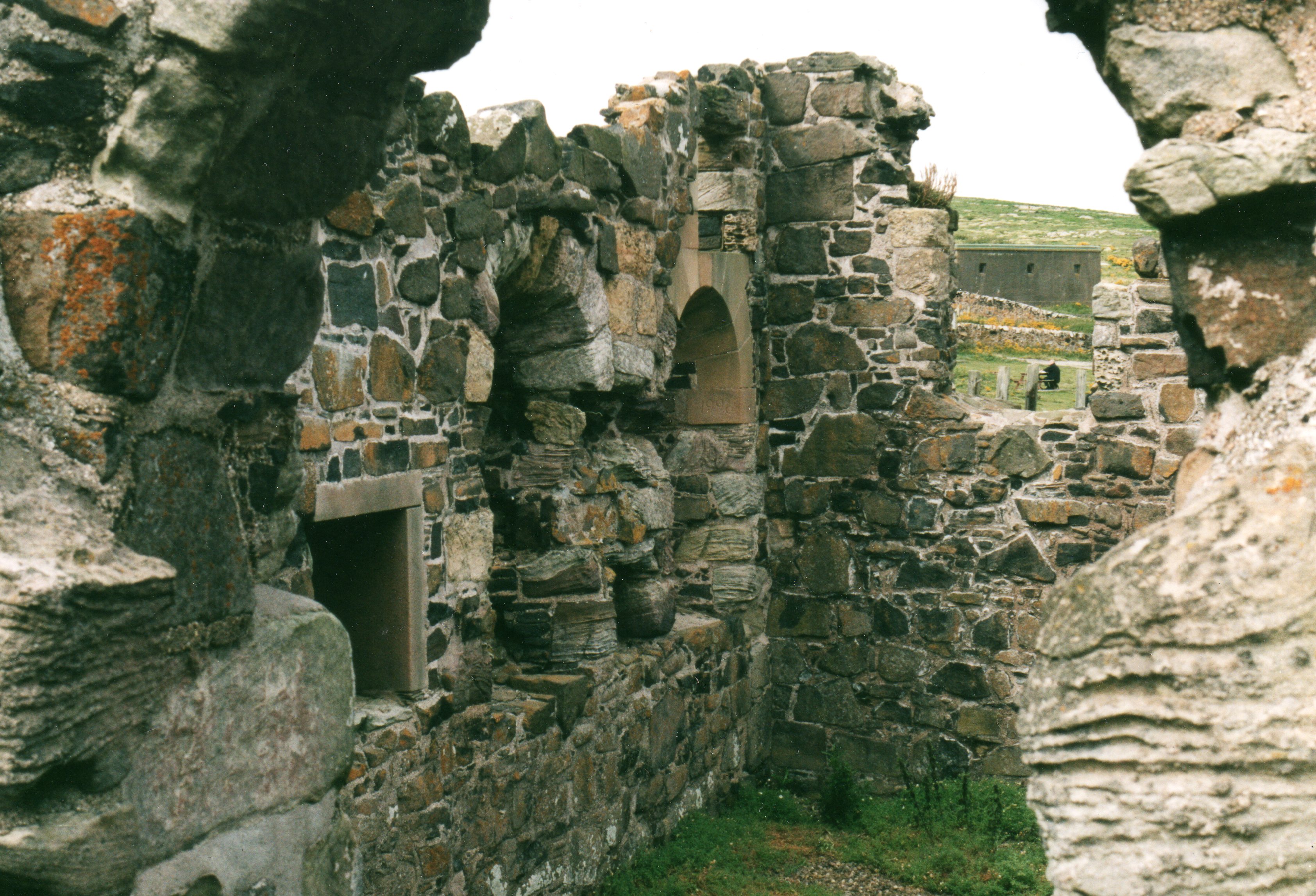
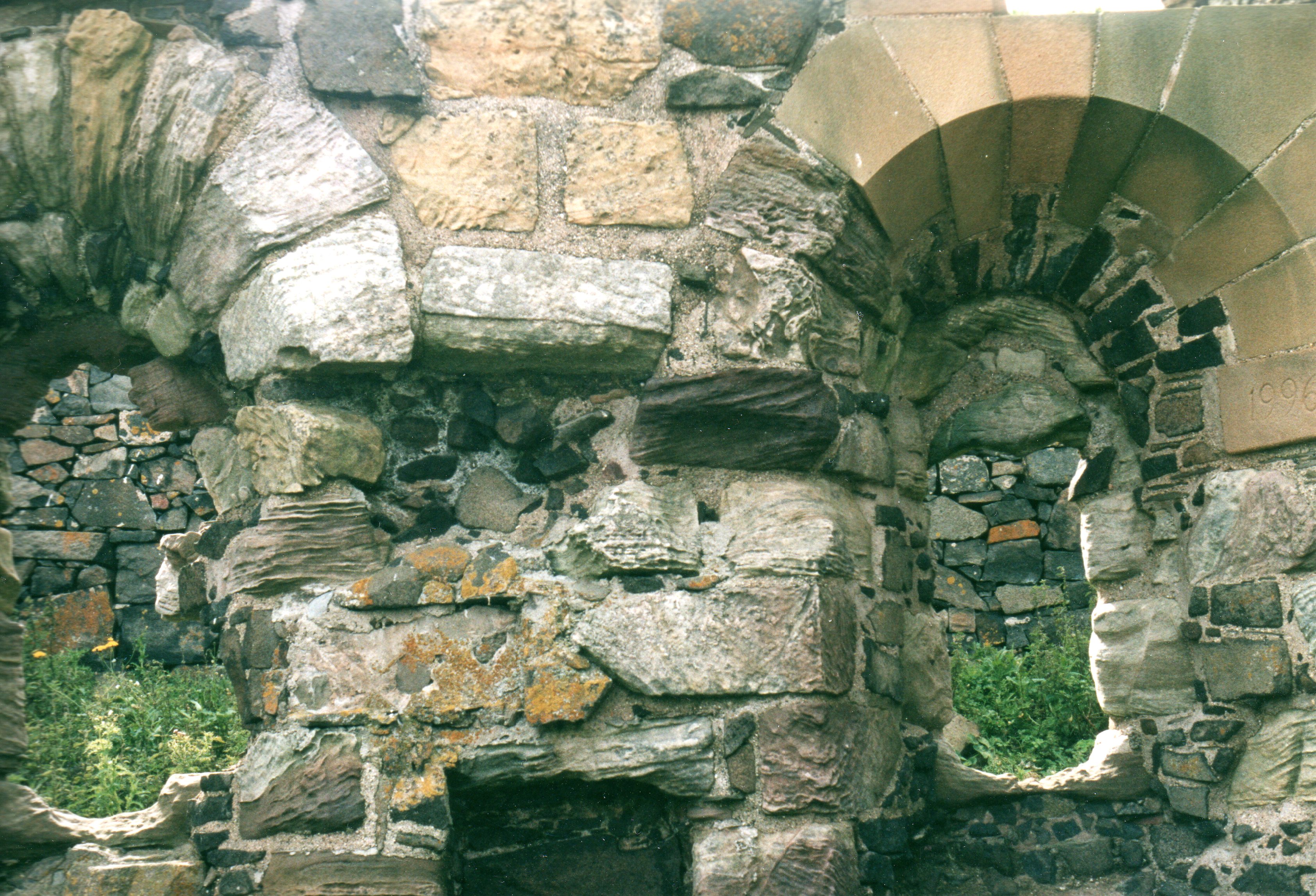
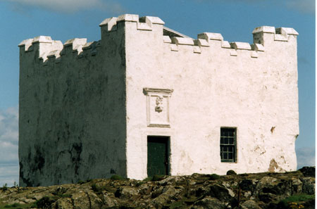
Chapel of St Adrian
Much has been written of this lovely ruin near the Kirkhaven landing. Historic Scotland stone masons have done some excellent restoration work preserving the lancet windows. These windows, lancet on the outside, widely flaring to Norman arch on the inside are all that remains with really ecclesiastical appearance. Outside they are obtusely pointed. St Adrian was killed by pillaging Danes in 875 AD. The priory built on this site in the C12th was an important place of pilgrimage until, for reasons of safety, the monks moved to Pittenweem in the mid C16th. The chapel is the only part of the priory still standing but following archaeological excavation, floors, wall bases and pieces of columns can be seen giving an idea of the surprising extent and nature of the structure. Seeing and touching the stones one time travels nine centuries and if not conscious of the numerous medieval pilgrims making passage to the island the size of the priory speaks volumes. Travelling to the island is not just a trip in space but also in time. For more on the magic and romance of journeys see Anne Mustoe (10).
The light houses and bird observatory
The lighthouses on the May have an interesting chapter in Eggling. The first lighthouse in Scotland was built there in 1636. The light was a coal fired brazier on the roof of a two storey tower. Coal was hauled onto the roof of the building by a hoist and the resulting wear to the corner of the building can still be seen. A coal brazier produced unreliable and inadequate light, especially in bad weather when needed most. The loss of the two frigates Nymph and Pallas near Dunbar in 1810, due to mistaking a lime kiln for the May brazier, led to the construction of the present lighthouse, operational in 1816. Robert Stevenson suggested demolishing the old tower to avoid confusion with the new. Sir Walter Scott on visiting the island recommended ‘ruining it à la picturesque’. However it was reduced to a single storey and the building used by Forth pilots. The new lighthouse was electrified in 1833 but needed so many men to maintain it that in 1924 it was replaced by an incandescent mantle heated by vaporised oil.
The lower lighthouse was constructed in 1843 and it is now used as a bird observatory. Its purpose was to indicate to shipping coming from the Tay the position of the Carr rocks off Fifeness. It continued in operation until the end of the C19th when the North Carr lightship took over the function.
The bird observatory volunteers research migration and sea bird population dynamics, recording, ringing and operating a Heligoland trap (large permanent funnel trap).
More of the social and technical struggles of establishing and operating lighthouses on the Isle of May are covered by Bella Bathurst in “The Lighthouse Stevensons” (11). It is an extraordinary tale, amazingly lighthouses being opposed by some ship owners. In spite of mounting losses they doubted the necessity of lights and feared the cost of light dues. Others thought that dependence on lights would play into the hands of wreckers. The human cost included the 1791 disaster when the lighthouse keeper, his wife and four of his children were gassed by fumes from the brazier and in 1889, the assistant keeper rushing on the track to the Altarstanes to search for the wreck of the Newcastle Packet overstepping the corner now known as Burnett’s leap.
The Northern Lighthouse Board retains ownership of parts of the island necessary to its duties.
The May in War time
Whilst not fortified like the inner Forth islands, the strategic position of the May in the mouth of the Forth made it an important observation post. Shipping in and out of the Forth was monitored from the island using indicator loops (sea bed cables) and asdic.
The May has remarkable richness of history for such a small island so there is fascination in what has gone on there over the centuries. Prehistoric residents, monarchs, saints, pilgrims, world wars, smugglers, farmers, fishermen, lighthouse keepers, merchant seafarers, conservationists and tourists have all left their mark. With a close eye on the weather the Jewel of the Forth will not disappoint.
References
1. The Scottish Islands, Hamish Haswell-Smith, Canongate, second edition 2004, ISBN 1 84195 454 3.
2. Emeralds Chased in Gold, John Dickson F.S.A. Scot., Oliphant, Anderson and Ferrier, 1899.
3. The Isle of May A Scottish Nature Reserve, W.J. Eggling, Lorien Press, Kirkmichael, Perthshire, 1985, ISBN 0 948 201 01 0.
4. One Man’s Island Paintings and Sketches from the Isle of May, Keith Brockie, J.M. Dent and Sons Ltd., 1984, ISBN 0 460 04612 8.
5. Grey Seal, Common Seal An account of the life histories of British seals, R.M. Lockley, Andre Deutsch, 1966.
6. The Story of the May Island, Largo Field Studies Society, Upper Largo, Fife, 1971, fourth reprint 1992, 25pp.
7. Shipwrecks of the Forth, Bob Baird, Nekton Books 1993, ISBN 1 897995 00 8.
8. The K Boats, Don Everitt, The New English Library, 1972.
9. The Times, Saturday 13 August 2011.
10 Lone Traveller, one woman, two wheels and the world, Anne Mustoe, Virgin Publishing Ltd., 2000, ISBN 0 7535 0426 X.
11. The Lighthouse Stevensons, Bella Bathurst, Harper Collins, 1999 and Flamingo paperback 2000. ISBN 0 00 653076 1.
Paul Shave
yacht Blue Spindrift
26 January 2013